

Charting the waters
Charting the waters
Learning to figure the route for a sail

It’s easy to get a fix on a boat’s position using digital help. Looking at the chart plotter gives the latitude and longitude; and, adjusting the chart size gives a visual of where we are with reference to the shore. But what if we have a ‘power outage’? What if our systems malfunction?
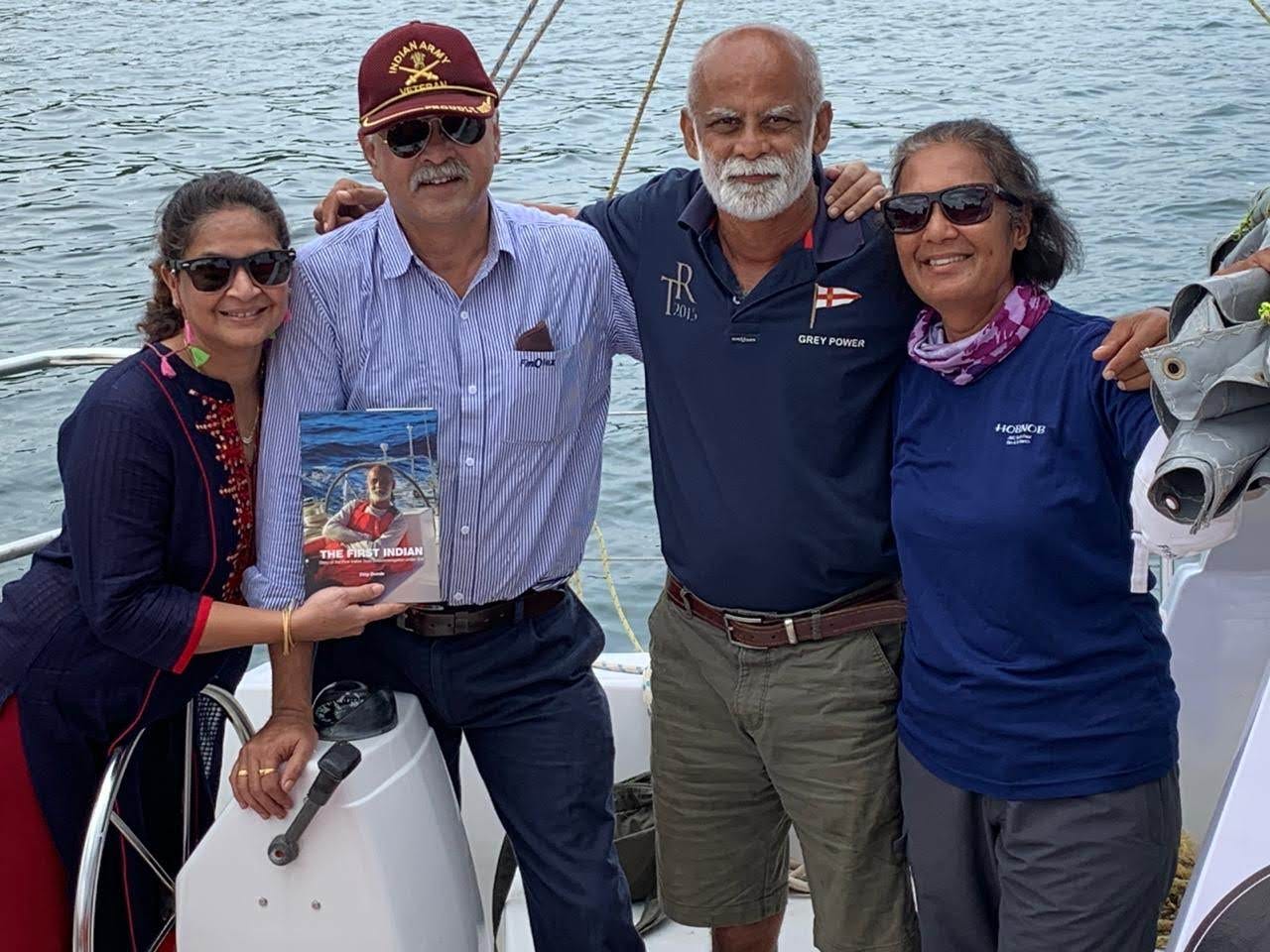
India has a line of lovely beaches and ports we want to explore. We started with the coast of Goa, then got a bit more adventurous. We have a list of places, and the first up was Pawas near Ratnagiri, in Maharashtra, on our first sail up to Bombay. Largely because we had friends there with the means to keep our boat safe in their private harbour whilst we ventured ashore to enjoy their hospitality: a big shout out to the Patankars and to Finolex.
On our trip back, we decided to explore Murud Janjira, an experience that didn’t turn out to be quite as pleasant as visiting Pawas. Antara got badly snagged in a multitude of fishing nets which jammed the propeller and tripped the engine. We had no option but to attempt to get into Murud, under sail, late that night. You can imagine our fury, when we realised that the path marked as a navigation channel on the chart was criss crossed with nets! Netted into immobility through the night, we sailed alongside a Coastguard ship berthed at Dighi port the following morning. Their crew helped us clear our propeller, topping that off with a hot breakfast.
That’s when we decided that we needed to make a habit to map out our route on a physical chart and populate it with our learning eg. don’t use the Murud channel but keep it to port when sailing in and hug the coast which has adequate depth for us.
Then again this is a good practise along the Indian coast as a lot of the smaller ports and coastal areas are not accurately charted on the Navionics’ ECS charts displayed on our chart plotter.
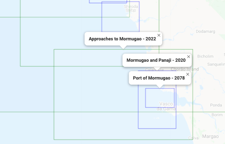
The National Hydrographic Office in India provides nautical publications and charts which can be easily ordered online. On Antara, we decide on the areas to explore and accordingly order charts for the level of detail we require.
It’s simple to plot a position on a chart. Take the latitude and longitude of the position, then draw a horizontal line from latitude scale on the right/left side of the chart to the latitude you have. Then draw a vertical line from the longitude scale to the longitude you have. The point where these two lines intersect is your position.
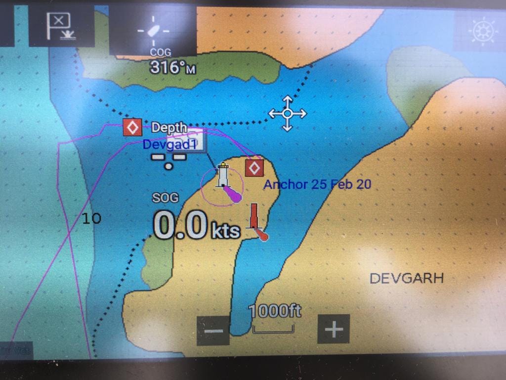
You can also do the reverse to find the lat/long of a particular point on the chart. This is what we did to ensure we could sail safely into Devgad harbour in the wee hours of the morning.
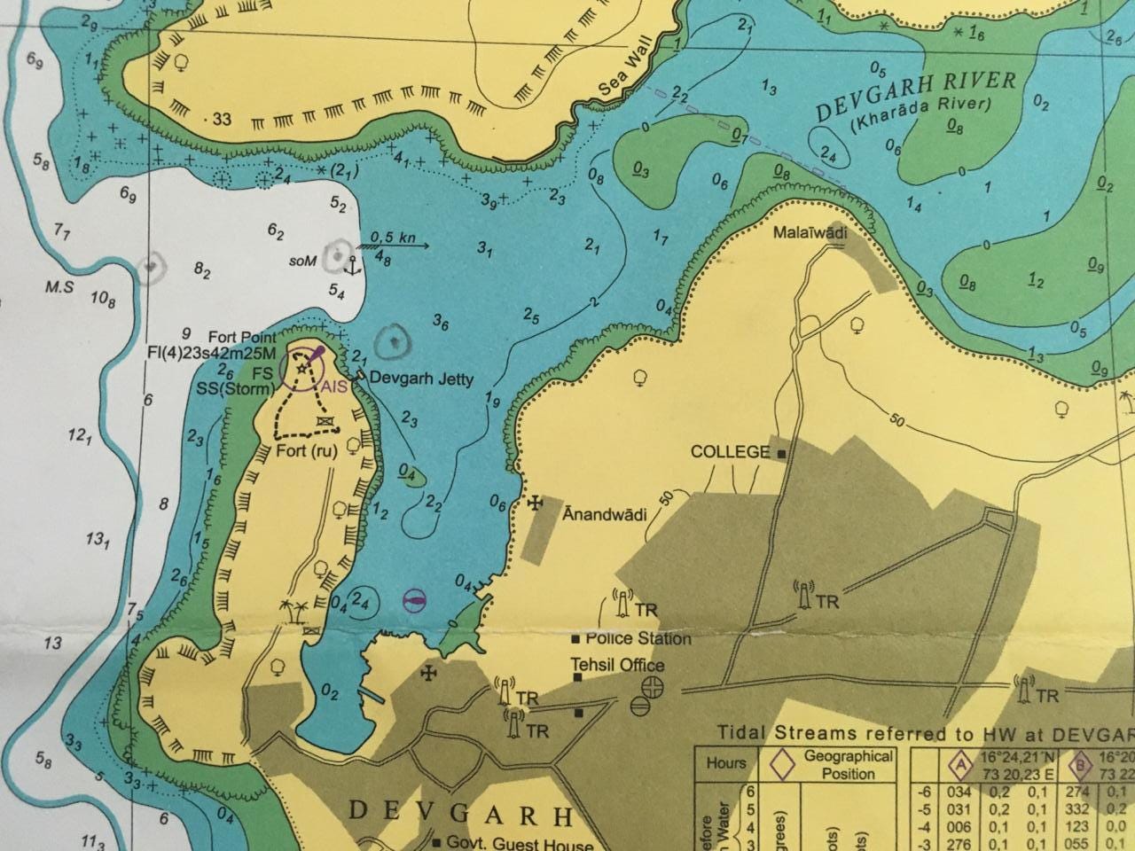
Since we plotted all the channel markers onto the electronic chart earlier in the day, the route thus created led us to a safe mooring even though the e-chart showed us anchoring on land!
To plot your position or route on a chart, all you need is a parallel ruler, a divider, and a soft lead pencil.
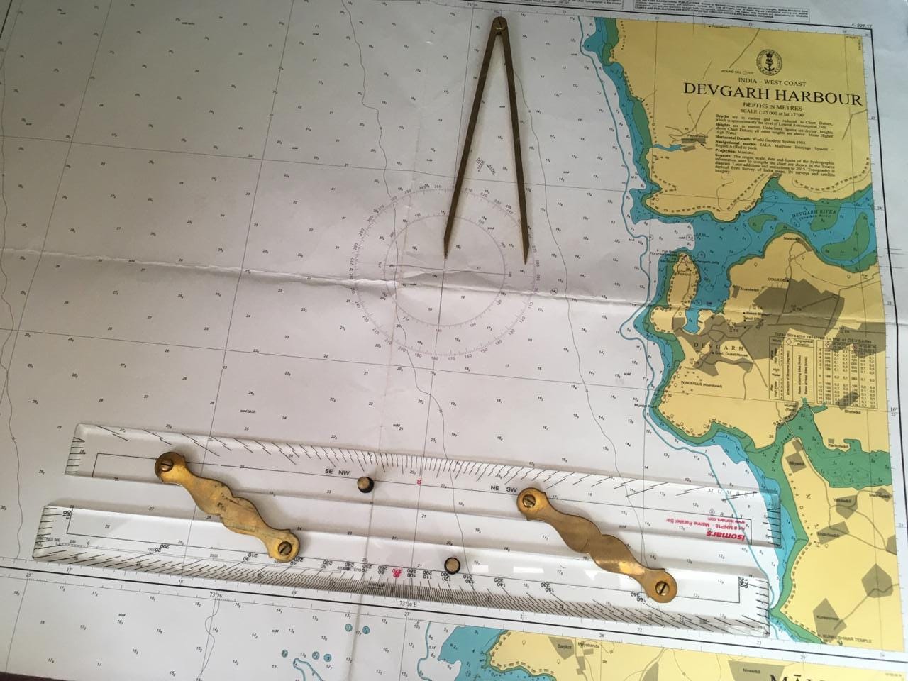
Let’s get started
Suppose I want to go from our anchorage in Dona Paula to Coco Shambhala near Sindhudurg. I will first make a safe point on the chart just outside the mouth of the harbour (15 deg 26’N, 073 deg 46’E) and another in the vicinity of Vengurla rocks (15 deg 52’N, 073 deg 27’E).

On reaching closer a more detailed chart is required to get to the anchorage, but a safe point near the rocks will serve to plot a route.
After drawing a line between the two safe points, align one leg of the parallel ruler along this line. Holding that leg tightly against the chart to keep it from moving, move the other leg out until its outside edge is at the center of the small cross in the center of the nearest compass rose.
If the ruler doesn't extend far enough in one motion, then pressing the moving leg of the ruler tightly to the chart bring the other leg to it. Moving one leg at a time while holding the other down ‘walk’ the course across the chart. When the ruler finally reaches the center of a compass rose, it will still be parallel to the original course.
Where the edge of the rule crosses the compass rose is the True course, in our case, from Panaji harbor to Vengurla rocks. This is the True course to steer and can be easily converted to the Magnetic course to steer, using our magnetic compass, by applying the variation as indicated by the inner circle on the compass rose above.
Now that we have figured out the direction we need to go in (the course to steer), 325 in this case; we measure the distance in Nautical miles. Placing the divider on the latitude scale we can get the exact distance between our current location and the destination. Divide this with the speed in Knots (Nautical miles per hour), and we know the approximate time to reach our destination.
Quiz time
Antara has an average speed of 5 kts. So, if we were to set sail from Goa at 9am, what time could be expect to be at the Vengurla rocks, in good sailing weather? Send in your reply in the comments box to win a free day trip for yourself on Antara!
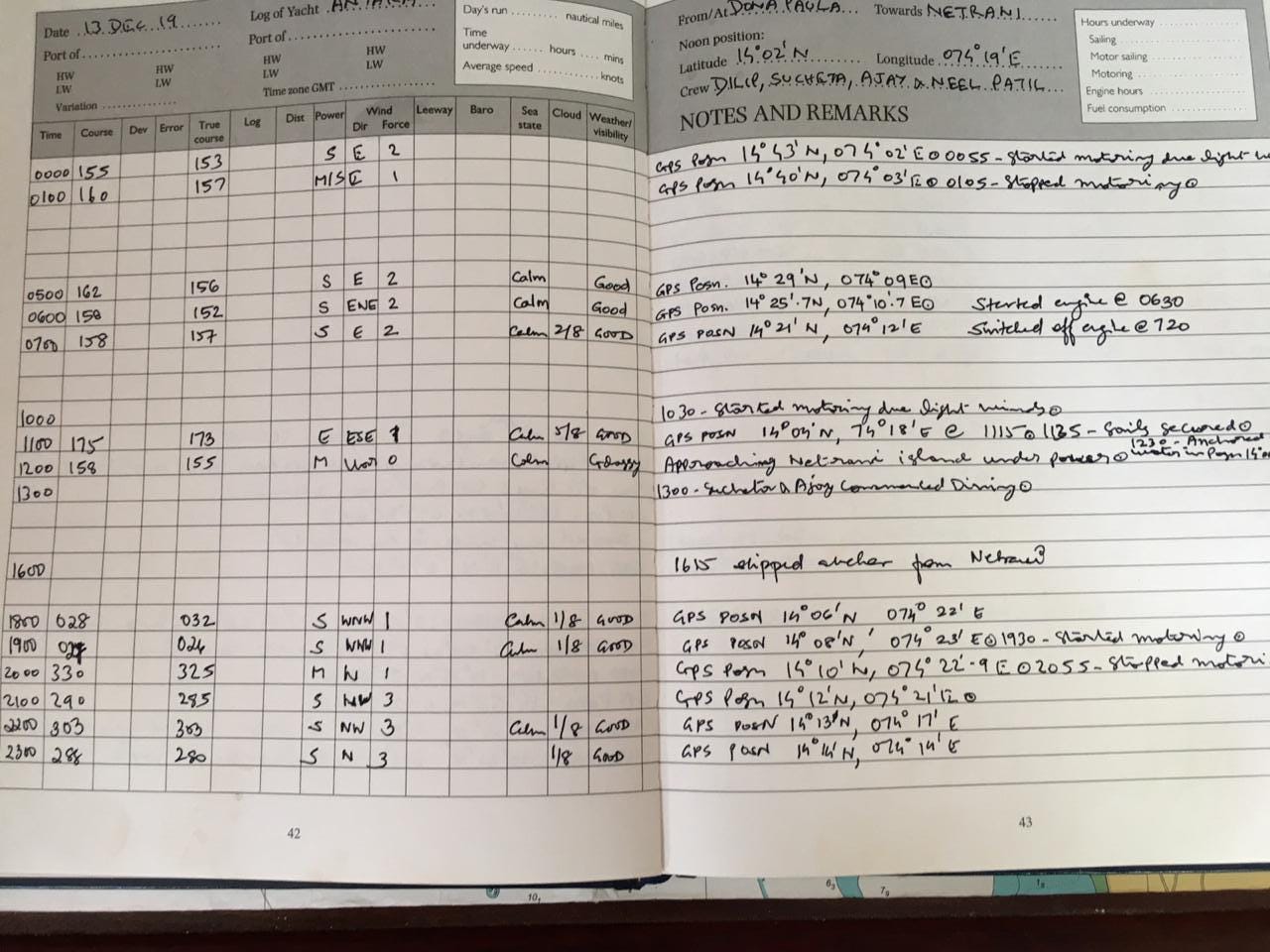
To ensure that we have all this information stored and handy for subsequent trips, we maintain a logbook. This is an (almost) hourly record of every trip Antara sails.
Ok, we’re all kitted out and ready with the charts too. Now before we cast off, how about we figure the sails and how exactly we use them to move the boat. Sounds interesting? Then look out for our next newsletter!
You can also check us out on Facebook, Instagram, Youtube or visit our website
3:20 pm ?
I will ask Jo to try this ...